
PAGASA not ruling out Signal No. 3 due to Tropical Storm Aghon
Source: Rappler
Author: Acor Arceo
MANILA, Philippines - The weather bureau is not ruling out the possibility of raising Signal No. 3 in the eastern portions of Aurora and Quezon in case Tropical Storm Aghon (Ewiniar) becomes a severe tropical storm near the two provinces.
Earlier, the highest expected tropical cyclone wind signal was only Signal No. 2.
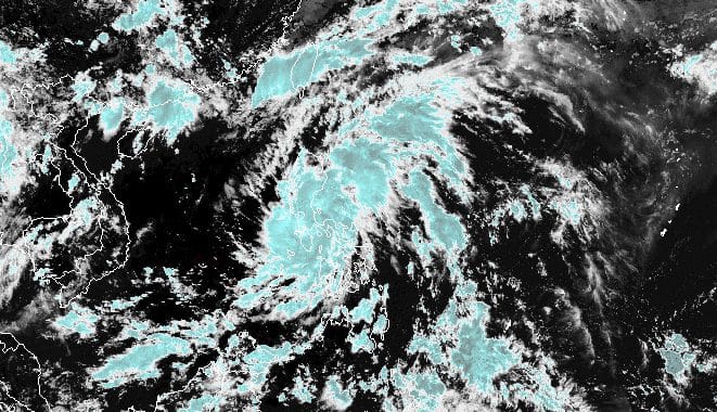
As of 1 pm on Sunday, May 26, Aghon was already over Mauban, Quezon. It has shifted northeast, moving slowly.
So far, the tropical storm still has maximum sustained winds of 75 kilometers per hour and gustiness of up to 125 km/h.
The Philippine Atmospheric, Geophysical, and Astronomical Services Administration (PAGASA) said in its 2 pm bulletin that Aghon will keep moving over mainland Quezon and Polillo Islands, also part of Quezon, within 12 hours.
It is expected to be off Quezon's eastern coast on Sunday evening, where there is a chance it may intensify into a severe tropical storm.
As of 2 pm, several more areas have been placed under tropical cyclone wind signals.
Gale-force winds (62 to 88 km/h), minor to moderate threat to life and property
Strong winds (39 to 61 km/h), minimal to minor threat to life and property
For rainfall, PAGASA maintained its forecast for the next two days. Aghon will continue to dump moderate to torrential rain within 24 hours, which means floods and landslides may still threaten affected areas.
In a new storm surge warning at 2 pm, the weather bureau said there is a "minimal to moderate risk" of storm surges over the "exposed and low-lying coastal areas" of Cagayan, Isabela, Central Luzon, Metro Manila, Calabarzon, Occidental Mindoro, Oriental Mindoro, Marinduque, Romblon, Camarines Norte, Camarines Sur, and Burias Island within 24 hours.
Meanwhile, the gale warning released at 11 am remains in effect. It covers the coastal waters of Aurora, Quezon, and Marinduque, as well as the southern coastal waters of Batangas and the northern coastal waters of Camarines Norte. PAGASA said travel is risky for small vessels, "including all motorbancas of any type of tonnage."
Outside those areas under the gale warning, Aghon will still cause moderate to rough seas in the northern and eastern seaboards of Luzon and the seaboard of Bicol. Waves are 1.5 to 3.5 meters high, so small boats must take precautionary measures, or if possible, avoid sailing altogether.
Earlier, Aghon made landfall eight times in a roughly 29-hour period:
Starting Monday, May 27, Aghon is expected to gradually speed up northeast while intensifying. It may strengthen into a typhoon by Tuesday afternoon or evening, May 28.
It is projected to leave the Philippine Area of Responsibility (PAR) on Wednesday, May 29.
Aghon is the country's first tropical cyclone for 2024. (READ: LIST: Philippine tropical cyclone names in 2024)
PAGASA previously estimated that one or two tropical cyclones could form within or enter PAR in May. - Rappler.com